| Baccalieu Trail Heritage Corporation |

|
|
|||
New Discoveries
| Date: Aug. 12th '16 | |
| Time: 9:45 | |
| Title: Structure 9, August 11, 2016 | |
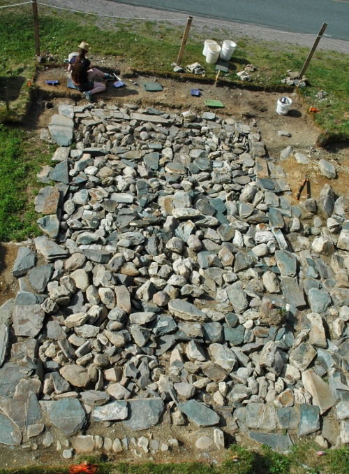 | |
| Entry: August 12, 2016 The photo above shows Structure 9 as it looked at about 4:30 pm yesterday (August 11, 2016). Although we can't extend the excavation much farther north because of the road, we have extended it north by 1 metre. We will be digging here for the remainder of this week and next week. | |
| Date: Aug. 4th '16 | |
| Time: | |
| Title: Structure 9 01 | |
 | |
| Entry: Image Above: Structure 9, July 27, 2016. | |
| Date: Aug. 3rd '16 | |
| Time: 11:20 | |
| Title: Structure 9 02 | |
 | |
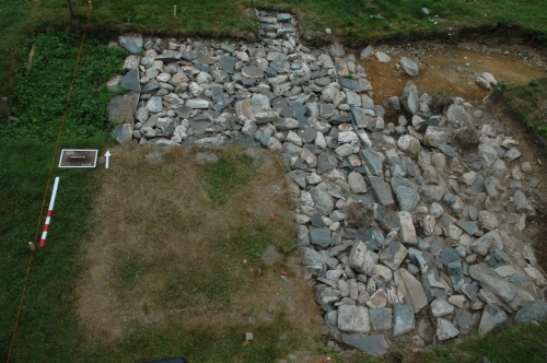
| Entry: Image Above: Structure 9, August 2, 2016. | |
| Date: Aug. 3rd '16 | |
| Time: 11:12 | |
| Title: Structure 9 03 | |
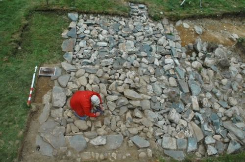 | |
| Entry: Image Above: Structure 9, August 3, 2016. August 4, 2016 Over the past week at the Cupids Cove Plantation PHS our crew has been busy exposing the southwest corner of Structure 9. The three photos above show some of the stages in that process. During the next few days we will be uncovering part of the north end of Structure 9, and, next week, we'll return to our excavations in the pit to the east of the structure. To learn more about Structure 9 and the pit, see the entries for July 21, 2016 and November 6, 2013 below.
| |
| Date: Jul. 21st '16 | |
| Time: 16:10 | |
| Title: 17th-Century Pit East of Structure 9. | |
 | |
| Entry: Image Above. Looking west. Uncovering the rubble in the 17th-century pit east of Structure 9.
July 21, 2016 Excavations conducted at the Cupids Cove Plantation PHS in 2014 and 2015 on the bank that rises up just east of Structure 9 have revealed a pit that was dug into the bank early in the 17th century. At this point the exact dimensions of the pit are unknown but it measures at least 5m from north to south and extends east from Structure 9 for more than 2m. The pit is full of large-to-medium sized pieces of rubble that clearly were deposited in the 17th century. The silt matrix around the rubble is full of 17th century artifacts and there is a 10cm thick layer of silt and beach gravel above the rubble that contains exclusively 17th century material. Above the silt and beach gravel matrix is a 10cm thick deposit of fine silt with no cultural material that seems to have accumulated during the 18th century. This is capped off by a roughly 40cm thick deposit of field stones. silt and humus that contains a small amount of late 18th, 19th, and early 20th century material. As mentioned below, Structure 9 appears to be some sort of harbor-side facility, possibly a dock or wharf. While we can't say for certain at this time, it is possible that the rubble in the pit is collapse from a building that was located east of the wharf and the pit was part of that building. If this is the case, the building must have collapsed sometime during the 17th century. Over the next few weeks we will be extending our excavation farther east and exposing more of the pit. | |